


A front that pulled through Tuesday first brought us rain, then some cooler air. However, the front didn't make it too far, as it remains stalled of the coast of North Carolina. With moisture remaining across the region and cold air continuing to seep in, we may be looking at the ingredients we need to see some snowflakes here across the Piedmont late this week.
Thursday will bring another day of cloudy, cool weather, with highs topping off in the low to mid 50s across the Piedmont and upper 30s for the High Country -- a typical early December day. Things begin to get a bit more interesting overnight.
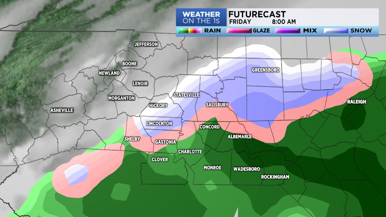
Moisture will continue to increase from the south, with rain creeping into the eastern Piedmont late tonight. At the same time, a reinforcing shot of cold air will approach from the northwest, and begin trickling into the area by Friday morning. With cooler air moving in and rain pushing in from the south, we may see some snowflakes fly as early as tomorrow morning with chances increasing Friday night into early Saturday. The questions remains: Where will the coldest of the air and the moisture overlap?
For now, the most favored area appears to be along and to the north of the I-40 corridor. This is where we will have the potential to see perhaps a dusting up to an inch of snow, with the bullseye being the Triad. Given the warm ground temperatures, however, impacts overall should be limited, with any accumulation confined mainly to elevated surfaces. Here in the Piedmont, for areas south of I-85, it is looking more likely that we'll just see some sloppy wet snow flakes mixed with rain with no accumulation at all.