


A lot of things to consider over the next 48 hours as cold air and moisture will try the "Winter Tango" across our region. A couple of things that need to be kept in mind are:
1) Piedmont soil temps were near 50s Thursday afternoon.
2) We still lack a dominant high anchored over the NE to drive the steady supply of cold air we need for big wintry shenanigans.
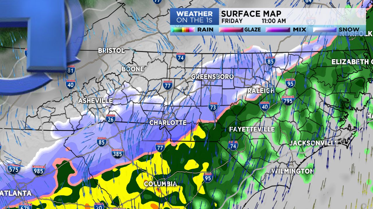
We'll look for a cold rain tonight across Charlotte zones with the possibility of some snow mixing in for the morning hours Friday. We will be above freezing outside of the mountains tonight. Even with pretty flakes of snow Friday morning, if they do show up, a light cold rain will be the main issue with roads not having any problems (see ground temps).
Periods of light rain should continue into Friday evening. We may see this end with all snow into early Saturday morning.
My only concern would be for bridges and overpasses early Saturday morning, if moisture is still active. As of this post, we should see some clearing by Saturday afternoon.
Our mountain and foothills counties are in a better position for mainly a snow event. High Country will see a few rounds of snow with 2-4" possible through Sunday, in total.
Bottom line, the mountains and foothills are the likely winner in the accumulation wars, while the Piedmont could see some pretty snow, with minor accumulations on grassy surfaces, but surface streets should be fine. A minor event at best. But we'll be watching for the hidden potential. Changes can occur.
Keep checking in the Weather on the Ones!