


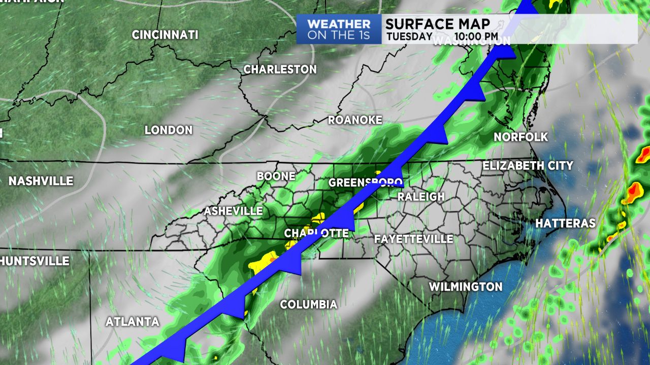
A strong cold front extending from New England into the Deep South will shift eastward across the Carolinas late today into tonight, first bringing rain and then a major cool down to follow.
After a unseasonably warm start to the month of December, this will, alas, come to an end this week. A strong frontal boundary will move through the area late Tuesday afternoon into Tuesday night, bringing rain in the High Country by the mid-afternoon hours before shifting east into the Piedmont tonight.
Peak rainfall rates should be near midnight for Charlotte before tapering off as the fronts shift east of the area by Wednesday morning.
With the front now expected to stall out off the coast, expect an additional chance for light showers Wednesday afternoon.
Behind the front, a cold, arctic airmass will move in. Temperatures will steadily drop throughout the week, with highs only managing to reach the 40s by Friday into the weekend.
Shots of moisture moving in through the end of the week will allow for lingering clouds and small rain chances through Saturday.
Light snow will be possible across the mountains by late this week with perhaps even a few flurries possible across the northern Piedmont.