


An area of high level cloudiness across portions of the Tennessee River valley will continue to push low-level clouds across western North Carolina Tuesday morning.
High pressure building across the eastern United States will scatter out the clouds by late Tuesday as it budges its way southward, allowing for a relatively nice end to the day.
Temperatures will run a bit cooler than average, with highs only managing to reach into the 50s across the Piedmont and 40s for the mountains.
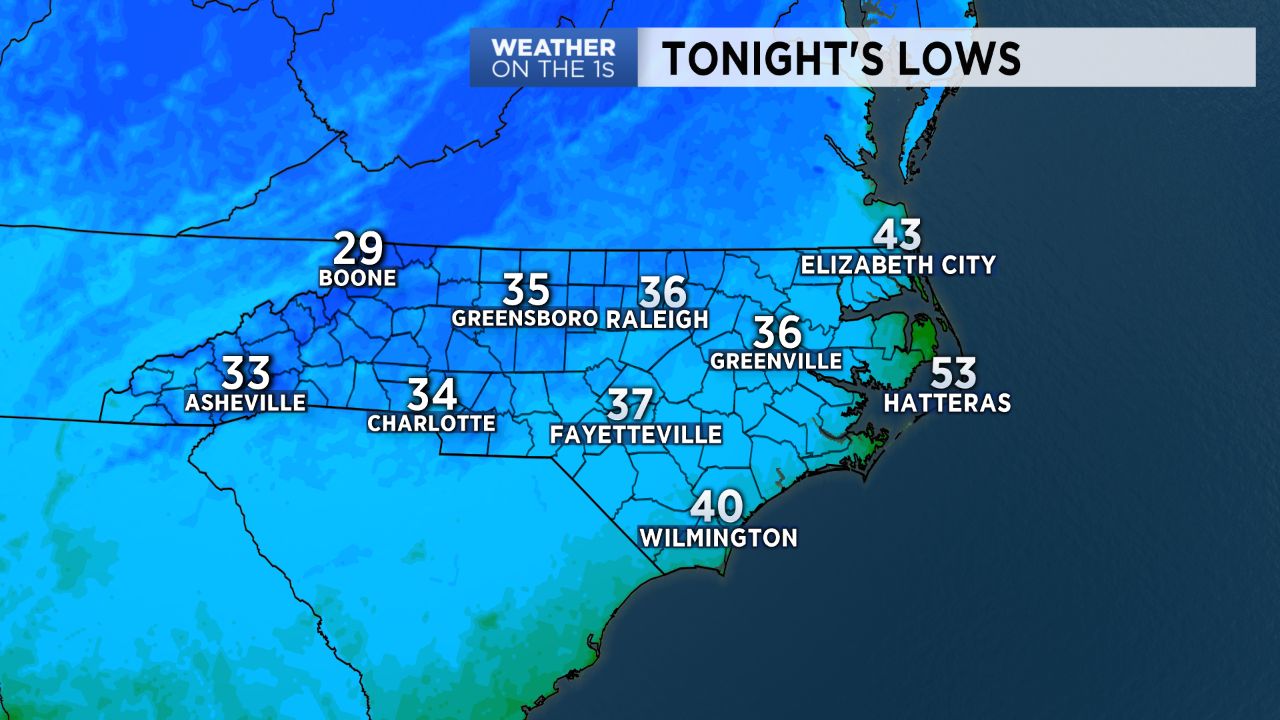
With skies continuing to clear Tuesday night, plenty of radiational cooling will occur, allowing temperatures to bottom out to near, or perhaps slightly below, freezing across the Piedmont.
Despite the cold start, daytime highs Wednesday will make a bit of a rebound from Tuesday's as a warming trend kicks in and continues into Thursday only to see temperatures get knocked down again by the end of the week.
A strong cold front moving through Saturday will bring our next best chance for rain and a more drastic cool down for the week of Thanksgiving.