


The high water levels that caused flooding in Monday’s winter storm were likely some of the highest on record in Maine, giving a fraction of a preview of what the rising seas of climate change will bring to coastal communities in the next decades.
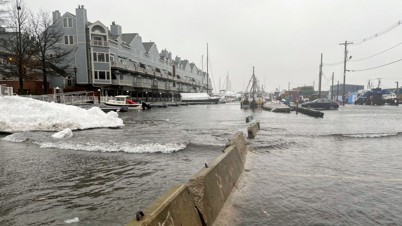
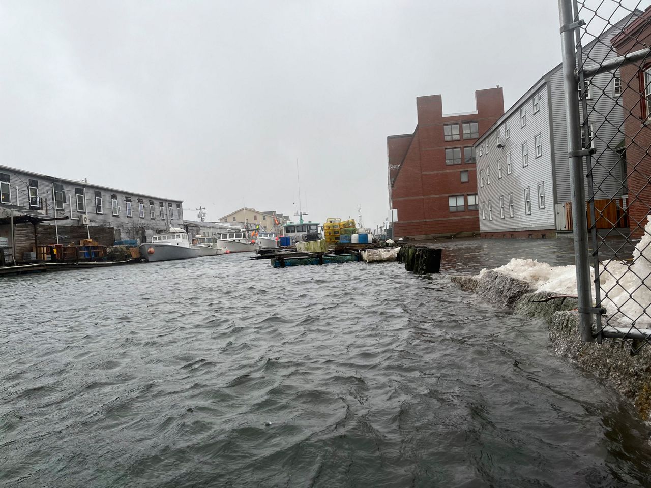
Streets, piers and parking lots were inundated on both sides of the Portland peninsula late Monday morning, with 1 to 2 feet of water covering the wharfs off Commercial Street and coming up through storm drains on Marginal Way.
Gayle Bowness, the municipal climate action program manager for the Gulf of Maine Research Institute, went out to photograph the storm on the Portland waterfront, where she said she saw a truck attempting to navigate through water that was up over its hood.
Monday’s 9.6-foot high tide wasn’t unusual on its own, Bowness said — but the wind, rain and atmospheric pressure of the storm added a surge of 3 feet or more, creating a total “storm tide” of at least 12.6 feet. Initial data shows the surge and storm tide may rank in the state’s top 20.
“The water level’s already up past flood stage for much of Maine, and then you add waves on top of that,” she said. “So the water is traveling much further inland than it typically would if it were to just kind of rise with the tide and fall. We had wave action in locations that you normally wouldn’t see it.”
Maine could see this kind of water level as its monthly highest high tide by 2030 or 2040 because of climate change, Bowness said. Sea levels in the Gulf of Maine have already risen by at least a foot since 1800, and state data shows that increase has accelerated sharply since the 1990s.
By 2050 — around when today’s millennials are nearing retirement age — the Maine Climate Council has recommended the state be prepared for 1.5 to 3 feet of sea level rise. By 2100 — when today’s young children are in old age — it says the state should be ready for 4 to 8 feet.
Bowness said worsening storms caused by the warming effects of greenhouse gas emissions will add to the erosion and infrastructure problems caused by those higher sea levels, as with the storm surge that fueled most of Monday’s flooding.
“Monday was a big storm, but it happened at a lower high tide. What if a small storm comes by when the tide is predicted to be 12 feet?” she said. “It’s going to really quickly shift from a nuisance to a major problem. And just the frequency of us being kind of exposed and vulnerable to these storms that come through is going to greatly increase.”
In the short term, she said, this will require more resources and proactive measures from local officials to close roads, warn people of hazards and clean up after floods. Farther out, cities like Portland may have to consider zoning or infrastructure upgrades to fortify stormwater systems and protect waterfront areas that are most at risk.
The joint One Climate Future plan for Portland and South Portland anticipates 1.5 to 3.4 feet of rise in Portland Harbor, and promises stormwater system upgrades and more resilience funding to help waterfront neighborhoods and businesses adapt.
Portland’s next highest high tide is forecast to be around 11 feet at the end of this month.